Helping reach the goal of zero damages.
GPSMapper is damage prevention software for visualizing geographic data. It's used by Pipeline Operators and Underground Utility Locators to visualize GPS data contained in One Call Tickets.
Fast & simple yet powerful
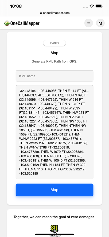
Obtaining a KMZ file can be a hassle or not even an option sometimes, and individually mapping a bunch of GPS points one at a time can be a tedious process. With GPSMapper, all you have to do is copy, paste, and boom instant KML file.
The main difference between KML & KMZ files is that KML files are supported by more apps and can store more data.
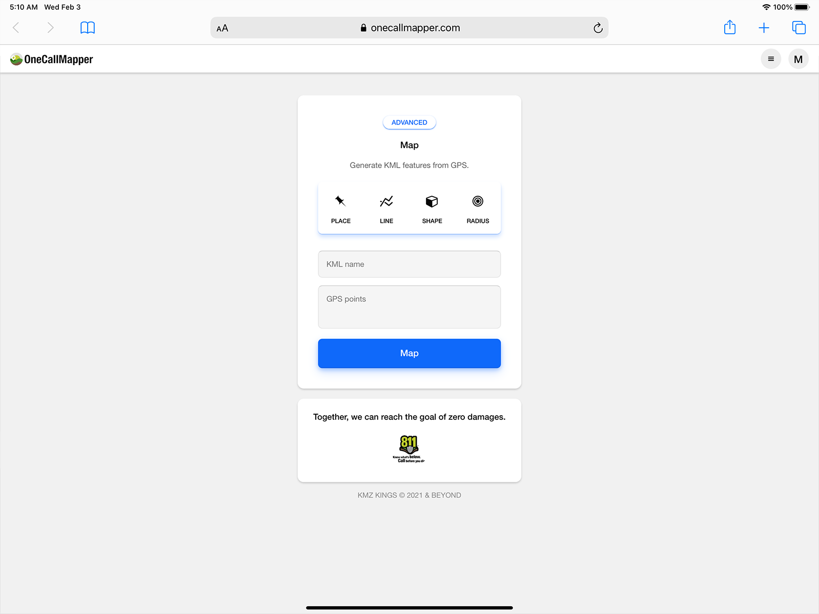
How does it work?
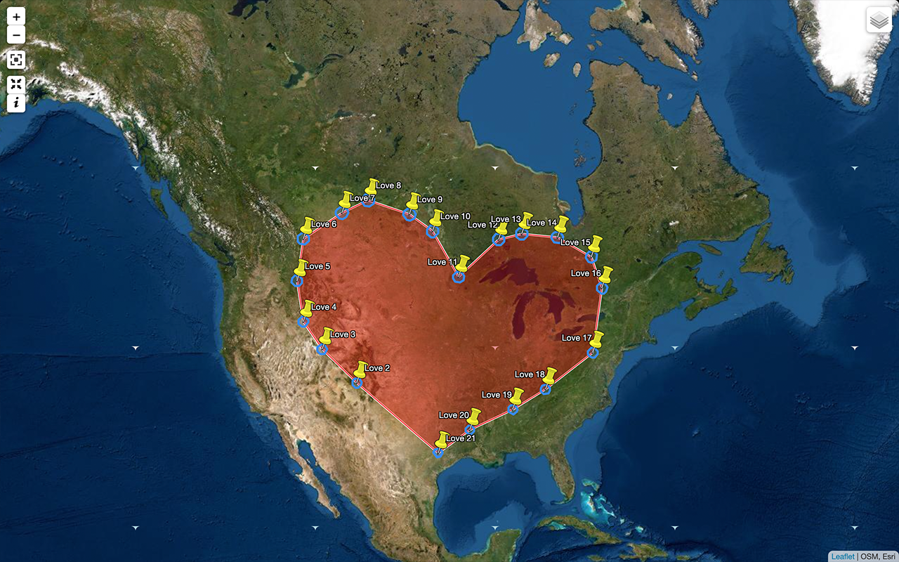
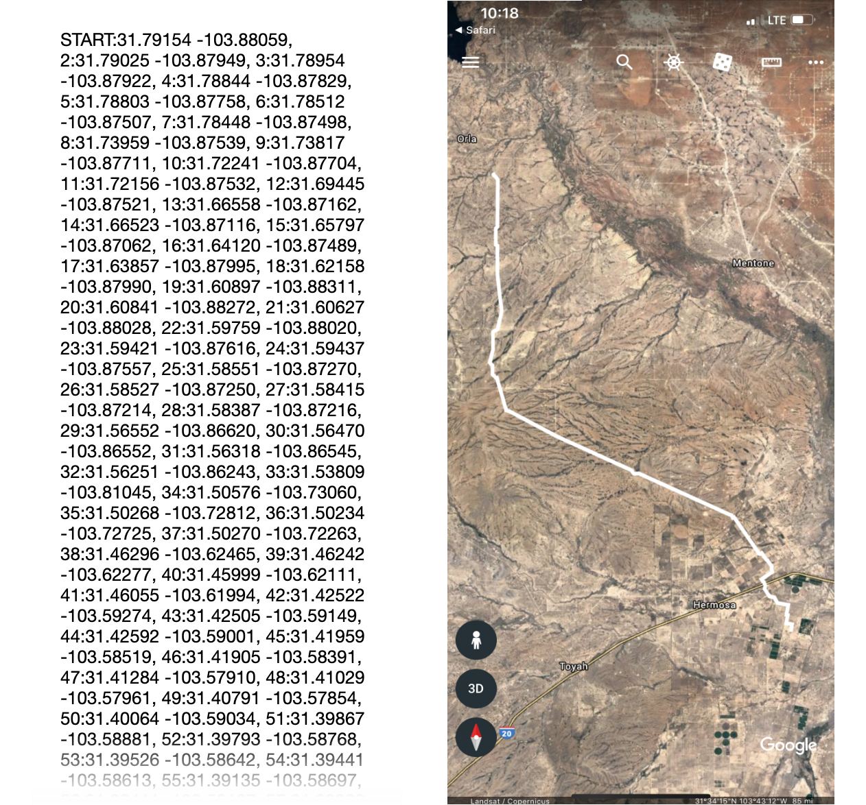
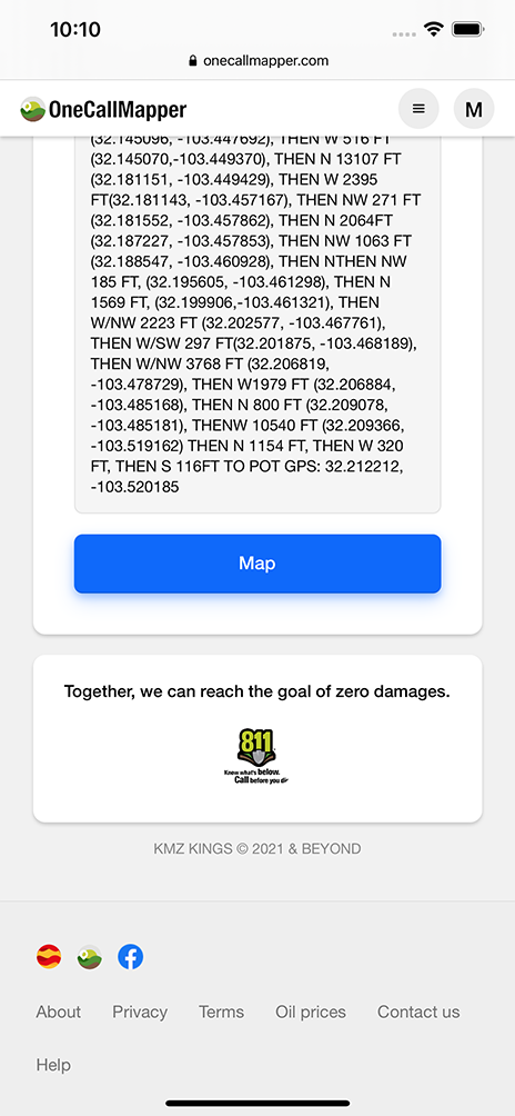
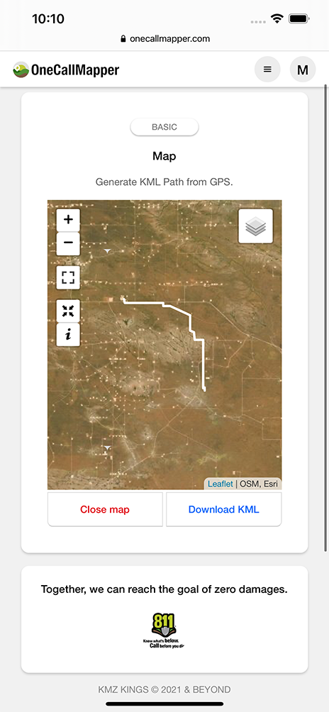
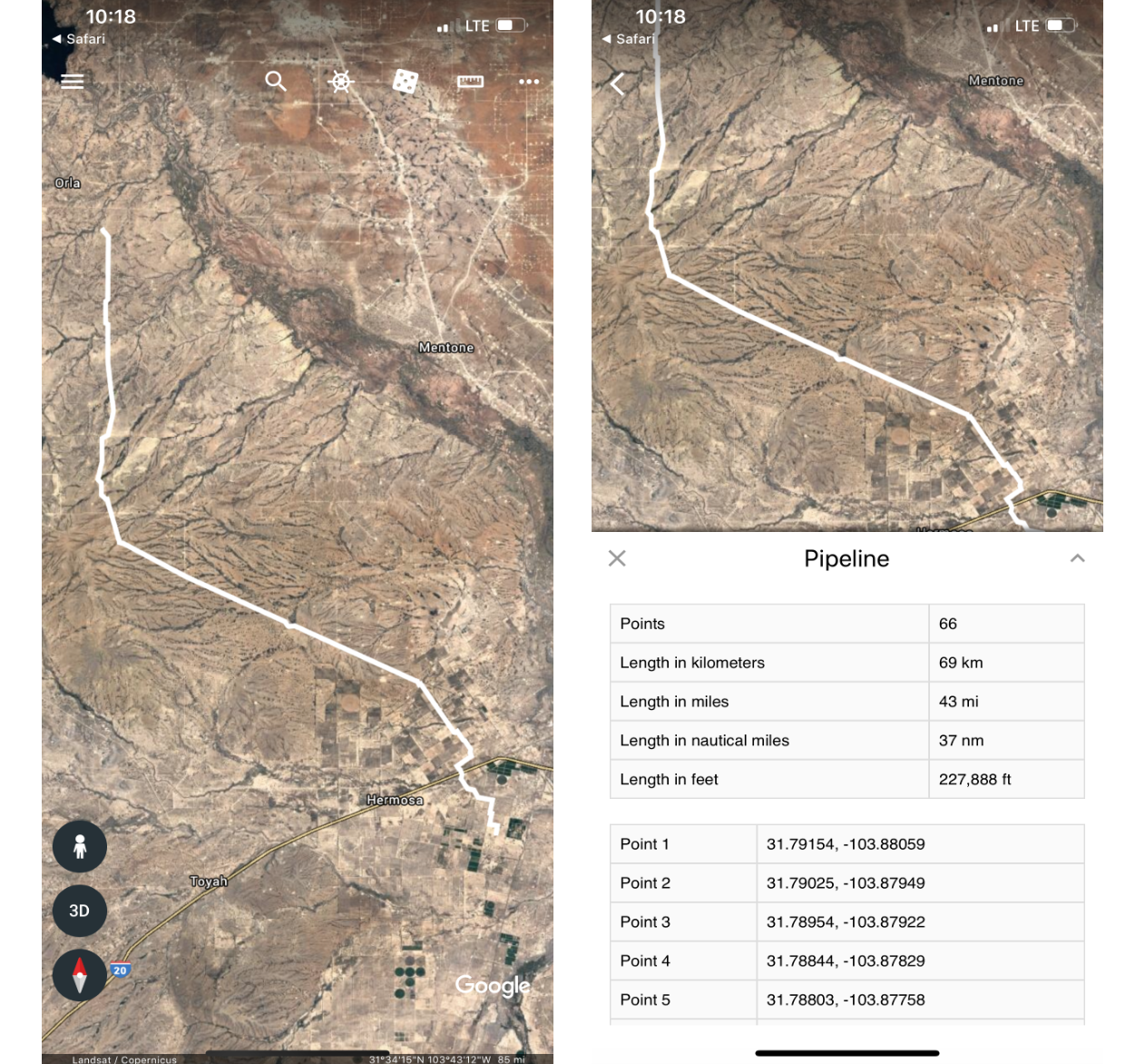
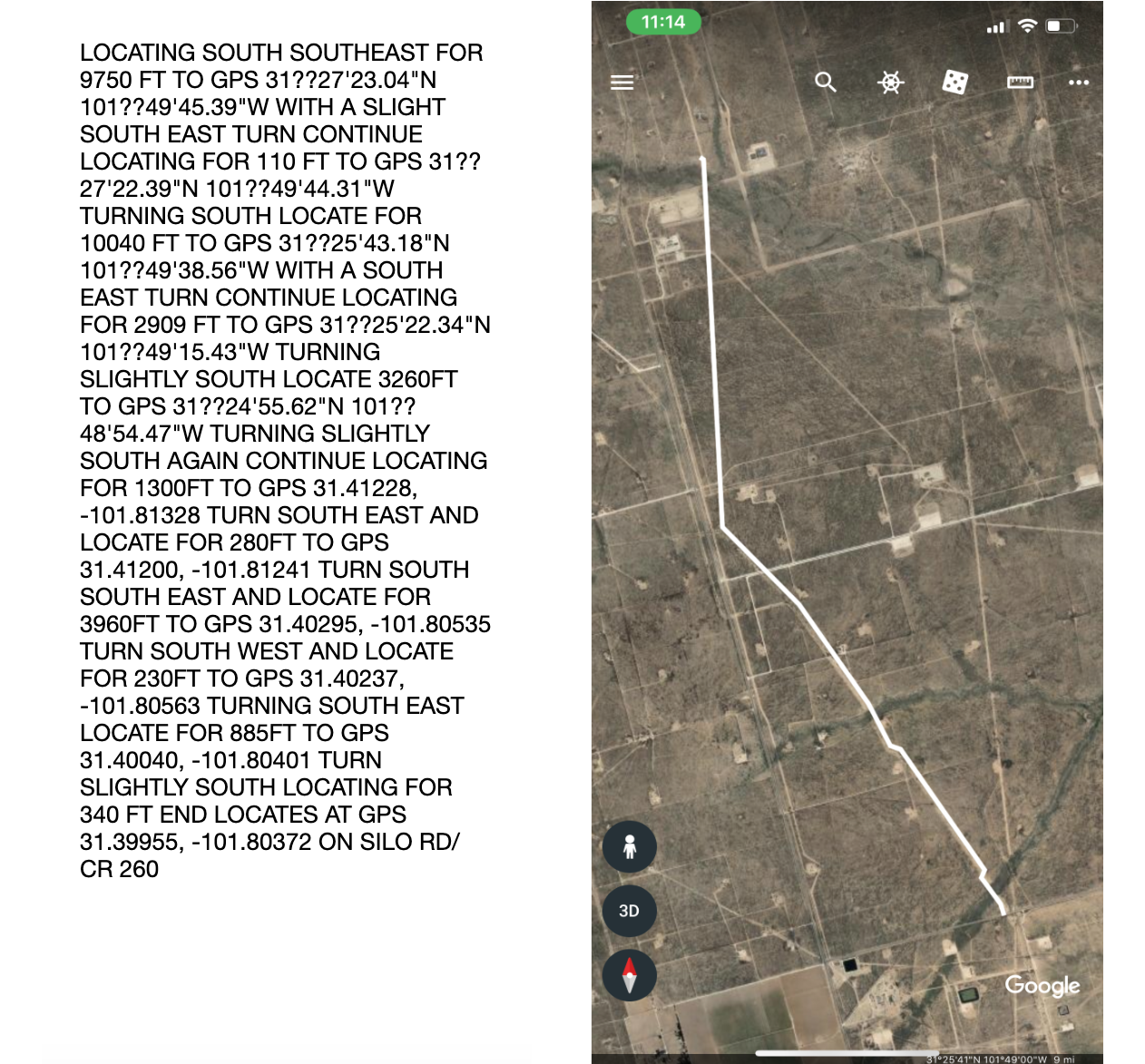
Add any text containing GPS points. Just make sure to include the first and last GPS points. With the click of a button, GPSMapper scans the text for GPS coordinates and plots them in order, and generates a KML file representing the data, which can be opened in Google Earth and many other GIS applications. Making it the ideal solution for visualizing One Call Tickets.
GPSMapper saves you hours of precious time that would otherwise be spent punching in GPS points.
Wether it's a single GPS point or hundreds, all you have to do is:
Copy
Add any text containing GPS data
Paste
Click map to generate a KML file
Visualize
View or download map as a KML file
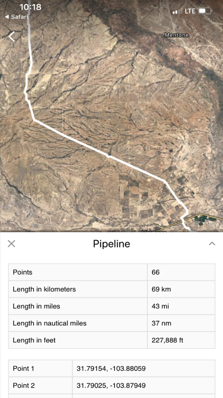
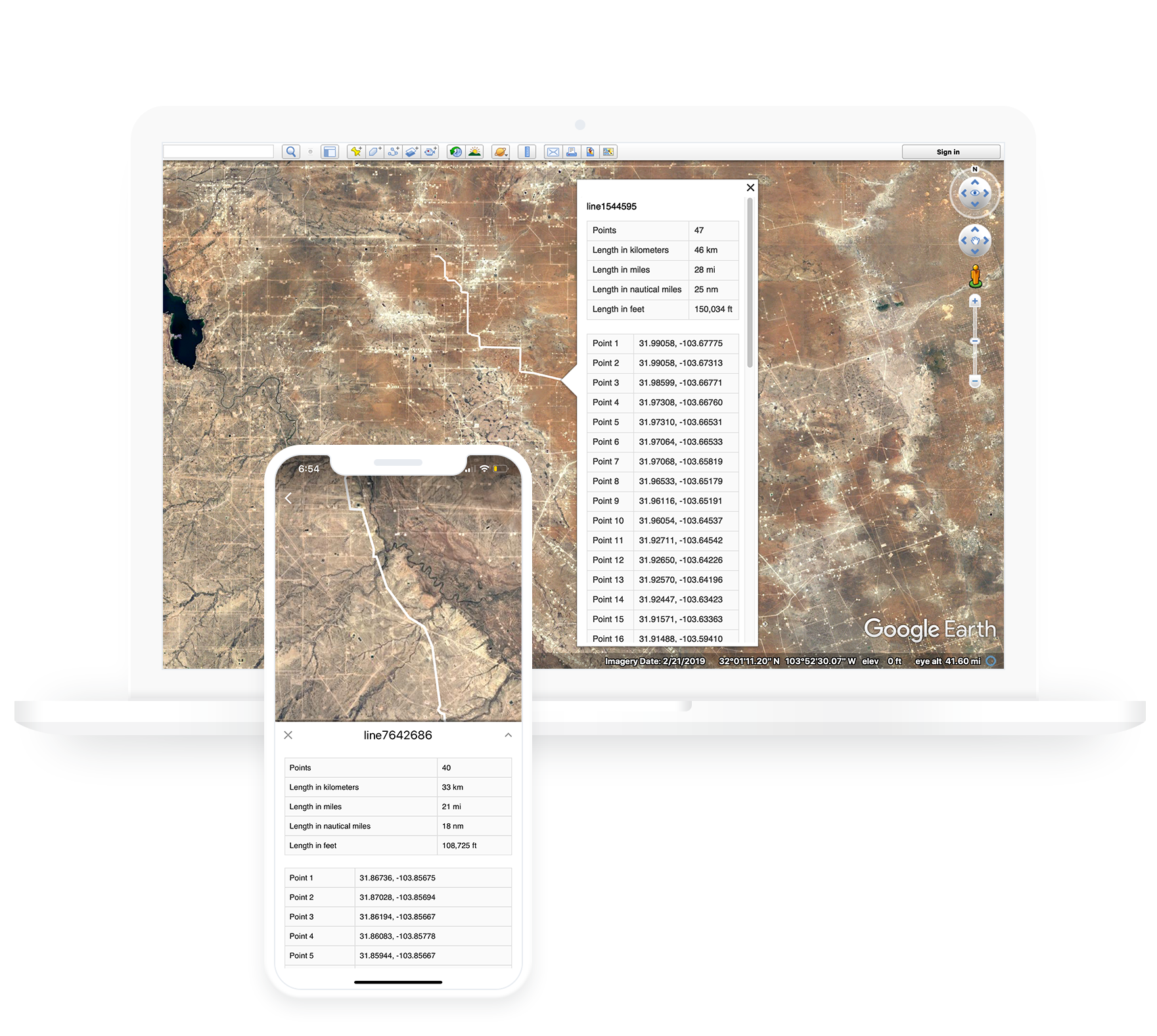
Calculates map distances
GPSMapper calculates the distance of maps and shows them in kilometers, miles, nautical miles, and adds them to your KML file as metadata. This metadata can be useful for people who need to know distances.
Simply click on your map in Google Earth to show it's metadata.
Mix & match GPS formats
GPSMapper supports the 3 most common GPS formats (Decimal degrees (DD), Degrees and decimal minutes (DMM), and Degrees, minutes, and seconds (DMS)) & allows you to mix & match GPS formats.
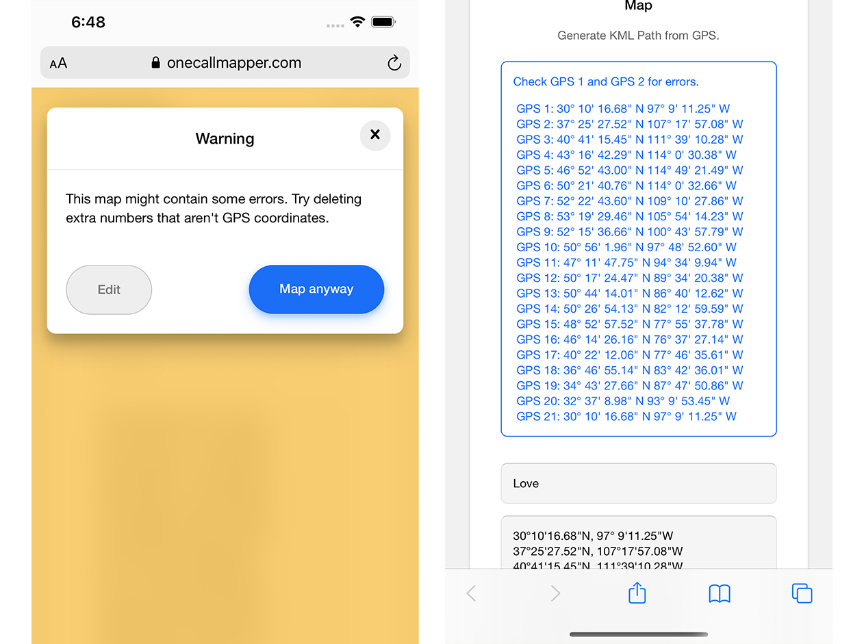
Detects user errors
GPSMapper detects & warns you about potential user-made mapping errors and gives you the option to edit your GPS or map them anyway, reducing the chances of generating bad maps.
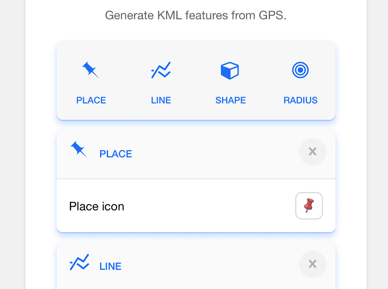
Choose KML map features
GPSMapper not only maps lines & locations, it also lets you choose which KML features to add to your maps including (Places, Lines, Shapes, and Radius in feet).
TRUSTED BY